Spider Collector's Journal (3rd page: 1991) Copyright © 2005 by Rod Crawford
As explained on the first page, most of these notes of fun (and not so fun) trips to collect spiders for research at the Burke Museum appeared in Scarabogram, newsletter of "Scarabs: The Bug Society," in their original forms. References to the editor mean me; most other persons mentioned are Scarabs members. Dates of field trips head each paragraph. Maps showing the location of sites within Washington state follow the grid system outlined in the Washington Spider Checklist. RETURN TO INDEX
|
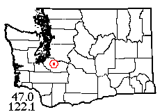
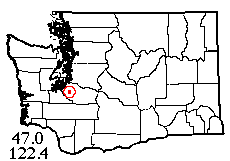
20 I 1991: Yr editor and his new student assistant (Karen Dorweiler) have been on two collecting trips so far this year, both successful. The first, on Jan. 20, was to the vicinity of Forest Lake, south of Orting, central Pierce County. With 3 people collecting, 6 hours in the field netted us 34 spider species - not bad for January. At one site on the edge of a marsh, the leaf litter was frozen so hard I had to cut it out in blocks, but on thawing and processing in the Berlese funnel, it yielded a normal amount of live fauna, including my first female of the "microspider" Grammonota zephyra.
 |
10 II 1991: On Feb. 10, the same team (with Gordon Pun as driver) went on a great loop through Penrose Point State Park (across the Sound from Tacoma), Goose Prairie (25 miles SW of Shelton, still with a little open salal-manzanita not yet overgrown), and two sites on Hood Canal; getting respectively 15, 15, 27, and 26 spider species. At the last site, a roadside ravine, just one small trash bag full of moss yielded 17 spider species. And on Feb. 16, Scarab Lars Crabo night-lighted in Discovery Park and got three species of moth! They were Egira hiemalis, the earliest-emerging Northwest noctuid; the odd geometrid Phigalia plumogeraria in which males have "big" antennae and females are wingless; and a small geometrid of the big genus Eupithecia. So who says "there's nothing to collect in winter"?
 |
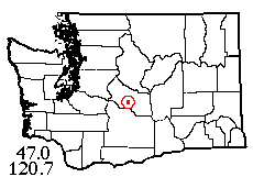
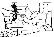
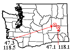
23 II 1991: On February 23, Scarab Bob Zahler attended a beekeepers' meeting in Naches (pronounced na-cheese), Yakima County, and dropped me off by the Naches River en route. After crossing a beaver dam to an island, I had nice, warm, sunny collecting for a few hours, though nothing was doing as yet in the vegetation department. An interesting observation from this trip concerns a "microspider," Spirembolus monticolens, very common in eastern Washington leaf litter. On the island, all specimens of this species (30 or more) were immature, but in a second leaf litter sample from above the road at the base of a north-facing cliff, almost all were mature. On a more recent trip (March 11), I got at least 32 species at a prairie-like powerline clearing on Murray Creek south of Fort Lewis. In western Washington, spring has definitely sprung!
 |
26 III 1991: On March 26, the day after the Scarabs meeting, Scarabs Albright, Pelham and Crawford, together with Charlotte A.'s friend Susan Masta*, bravely ventured into eastern Washington and a beautiful day. The butterfly contingent found the season rather early on Colockum Road, but in the same old Schnebly Coulee locality they did find the same old green hairstreaks. Meanwhile, yr editor had been dropped off to collect spiders in Joe Watt Canyon near Thorp. The day yielded some 26 species, including new species of Wubana, Scotinotylus and Ceratinopsis; a new state record for Enoplognatha wyuta; as well as a surprisingly soggy hillside liberally sprinkled with violets. [*Writing in 1991, who could have predicted the future for the somewhat spider-phobic Susan: she's now Dr. Masta, spider-woman of Portland State U.!]
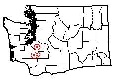 |
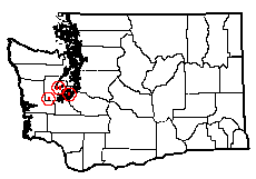
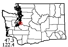
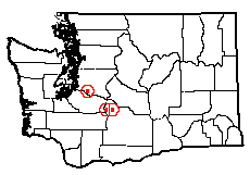
30 III 1991: On 30 March, yr editor took a motor pool car and his student assistant, Karen Dorweiler, and visited three areas in west-central Washington: a prairie/meadow just north of Kapowsin (Pierce County), several sites on various forks of the Tilton River (Lewis County), and a prairie-like pasture with a nice ash grove just east of Mossyrock, also Lewis County. Despite sampling varied habitats (forest, grassy clearing, tree plantation, and gravel bar), the Tilton River collection was rather lackluster, though adequate. The area near Mossyrock appeared promising, but the site was overgrazed. The Kapowsin site was added to the trip as an afterthought, but my sweep sample there produced a surprising number of really remarkable spiders, including one species I haven't yet placed as to genus! [It turned out to be Tiso vagans, a European species (and genus) new to Washington.]
 |
13 IV 1991: Saturday, April 13, yr editor went to Vashon Island again to give his "Spider Maternity" talk, and afterwards visited Lost Lake, a true Sphagnum bog, with Scarab Holtz to get a nice sample of 25 species including the minute bog spider Theonoe stridula and other moderate rarities. Scarab Pyle reports seeing "good slugs" here on another visit. Meanwhile, Scarabs Pelham and Hiruma were traversing the entire width of the Juniper Forest in Franklin County, in the process discovering a remarkable group of Lycaena rubida butterfly larvae being tended by ants on Rumex plants.
 |
21 IV 1991: On April 21, I went up the North Fork of the Snoqualmie River with my assistant Karen Dorweiler and her friend Kevin Pun. The object was to supplement a 1976 trip with my arachnology class, where we collected at three points and got not-quite-enough species at each point. The trip was successful in its object and even garnered a couple of unusual species. Then we went hunting for a famous Sphagnum bog called Kings Lake. Unfortunately, the route I chose to hike there was for the birds (i.e., only a bird could use it). No driveable road seems to go anywhere near the place, although it is leased by the U.W. from Weyerhaeuser for research purposes. [That was then; it's now a state Natural Area Preserve.]
 |
27-28 IV 1991: On April 27-28, Scarab Pelham went with Karen and myself to the Badger Mountain area in Douglas County. The area looks good, but it appeared to us that some disaster (pesticides?) has befallen the local arthropod fauna. On the first day, when we visited Ruud Canyon, Douglas Creek, and upper Titchenal Canyon, Jon saw less than half a dozen butterflies, despite good weather and plenty of suitable plant life. Despite much sweeping and beating, Karen and I got no more than one or two spider specimens from the vegetation, though there were some (with some interesting millipeds*) under rocks and in leaf litter. The next day we headed to lower Titchenal Canyon, where there is a Nature Conservancy reserve. The actual reserve area was difficult to penetrate because of rose thickets, but on the fringes, spider collecting was equally bad. Jon did find some worthwhile butterflies in this area, but not very many. What's going on here? [*The amazing red and black millipeds from under rocks in upper Titchenal were later described as a new species, Montaphe paraphoena. And we never did find out what was going on.]
 |
15 V 1991: May 15th (yesterday, as I type) I had a ride to the Fort Lewis area and, surprisingly, was able to get permission to collect on the military land with no trouble. In fact, anyone can go there for collecting, hiking, fishing or whatever if they know the procedure. [Details omitted because the procedure is doubtless very different in 2005, but it's well worth the time of any interested readers to inquire.] The area I collected was at the east end of Thirteenth Division Prairie (Range Control calls it "Area 15"). This is a typical South Sound prairie, very like Rocky Prairie and others in Thurston County. There is oak woodland near the stream. It was a lovely day and the camas was in bloom. The spiders were excellent and the butterflies (including a new colony of Euphydryas editha) not to be sneezed at. Five pitfall traps got over 50 spiders in a few hours! The more open middle area of the prairie is in "Areas" 13 and 14. There are plenty of other likely habitats waiting in remote sections of the fort!
 |
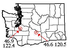
1-2 VI 1991: On June 1-2, Scarabs Pelham and Crawford headed for eastern Washington! While on Snoqualmie Pass, Pelham made the decision to head for the Columbia Basin, rather than the classic butterfly locality Moses Meadows, due to weather. Yr editor assumes no responsibility for this decision! In trying to get a sample for eastern Adams County, we hit upon Cow Lake, E of Ritzville, as one of the few tracts in the area that are non-wheatfield and non-No-Trespassing. The habitat is Palouse-type meadow steppe, highly invaded by Sisymbrium and other alien species but still fairly healthy-looking. Sagebrush is not prominent, and the only trees for miles around were a few choke cherries in the shelter of a cliff. The lake was producing numerous midges, in the clouds of which an occasional mosquito hid, waiting to pounce; but we quickly found out that the most annoying animal in the area was Dermacentor variabilis, our common cattle tick! Each of us pulled off at least ten before we stopped counting; I returned with a nice array of bites, including a row of several about 2-3 cm apart where the tick was apparently having trouble finding enough blood. I forgot my hat and got an impressive sunburn, including well-peeled ears. But on the brighter side, it was a lovely spot, the spider collecting was fairly good, and I got 27-29 species from an area where I had none before, showing some very interesting changes in abundance compared to western parts of the Columbia Basin, and one or two possibly new to the state. The butterflies and moths were fairly ordinary, but there were a decent number of species and worthwhile locality records. On our way back, we stopped off at Sylvan Lake, Lincoln County, where we had similar luck. Later in the month, Scarab Pelham was overheard telling Scarab Hiruma, "Don't ever go to Cow Lake!"
 |
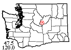
15 VI 1991: On Saturday, June 15, yr editor went with his assistant Karen Dorweiler and her friend Kevin Pun to the Bumping River area, in Yakima County east of Mt. Rainier National Park. The Bumping River, a tributary of the American River, is the outlet of Bumping Lake, which is impounded by Bumping Dam. The William O. Douglas Wilderness borders the east shore of the river, opposite the town of Goose Prairie. We hiked to this part of the river from a trailhead at Bumping Crossing, and collected no less than 37 spider species in the riparian habitats and the drier pine forest on the bench above. En route to and from the Bumping area, we stopped at two areas where I had partial spider samples, and easily upgraded these to 20+ species each. Our stop on the way there was Flaming Geyser State Park, a nice bit of woods well off the beaten track. The last stop, just east of Chinook Pass, was sampled in a chilly dusk rain but there were still some spiders under the rocks. A successful trip! Incidentally, there's still 6-8 feet of snow on Chinook Pass (though the road is clear).
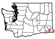 |
18-21 VI 1991. The "Great" Blue Mountains Expedition: On June
18-21, Scarabs Pelham and Crawford used up the rest of their fiscal year's travel
budget by undertaking an ambitious spider, moth, and butterfly collecting expedition
to the Blue Mountains of Washington, in Walla Walla, Columbia, Garfield, and
Asotin counties. The first day was spent at medium elevations on the Walla Walla
side, where the meadow steppe meets the ponderosa pine/Douglas-fir forest. Butterflies
were fair, spiders were reasonably good, and moths were excellent. The second
day, with high hopes, we camped on Pataha Creek, Garfield County ("Where
Agriculture is No. 1") in the forested north part of the Blue Mountains.
Here butterflies were good, spiders fair, but we didn't get to find out about
the moths! A couple of hours before sunset, the clouds moved in and the rains
came!
Next morning, things
were still wet, so Jon suggested going to a stretch of the Snake River south
of Asotin, a dry area with lots of cactus and the farthest east you can get
and still be in Washington. "If it's dry anywhere, it'll be dry there."
Well, guess what? Jon was a good sport and helped collect spiders in between
rain squalls. The spiders were reasonably good and included some of the more
interesting specimens of the trip; I had long wanted to collect in this area.
It was also nice to see a stretch of Snake River that is not yet dammed; there
was actually a rapids (Captain John Rapids) by our locality. But no Lepidoptera
could be collected. A curious observation: only one black widow was found, though
black widow egg sacs (inviable) were numerous. We theorized that maybe the egg
sacs rotted due to the unusually wet spring local residents reported having.
Neither of us was keen
on camping at Captain John Rapids (droves of cattle wandered through the site
now and then), so we spent a couple of hours checking out other spots in the
area. No luck. Finally I suggested a place I knew we could camp:
Choke Cherry Spring near Starbuck in northern Columbia County. We got there
at nearly midnight, but amazingly, it was dry and only partly cloudy. It didn't
even rain during the night, but in the morning it was becoming overcast even
there. In despair at the prospect of no more Leps for the next two days, we
gave up and headed for home. On the way, we checked out Gloyd Seeps north of
Moses Lake. The shrub-steppe vegetation at this site is unusually high quality
(apparently little grazing has occurred), but though I obtained a decent spider
sample, only two butterfly species flew during a brief filtered sun break in
the afternoon. Better luck next time!
 |
5, 11 X 1991: Yr editor has been exceedingly busy, giving spider lectures to diverse groups and elementary school classes. In connection with my semi-annual lecture on Vashon Island, I spent a few hours collecting at a field and marsh habitat on the southwest shore of the island. Despite the dryness of the season, I took a good variety of spiders (35 species), including a couple of moderately uncommon ones (such as the tiny mysmenid Trogloneta) but no big surprises. Later on, I had an hour or so to collect at a similar habitat in Spanaway, which was not so productive, netting 16 species.
 |
2 XI 1991: Yr editor has hired a new student assistant for the school year, Gil Matos, a freshman, and we have plunged into the business of collecting and processing spider specimens. On November 2, we went to Lopez Island, collecting in an upland meadow on Lopez Hill, a large field (sometimes marshy but dry when visited) by Hummel Lake, and shore habitats in Spencer Spit State Park. We netted about 30 species each from the two areas visited, including some unfamiliar ones. The coolest habitat was a rock outcrop just inside the forest from the upland meadow, with many loose mossy slabs of the fractured surface layer of rock to lift and reveal the spiders beneath!
 |
9 XI 1991: On November 9, Gil and I visited riparian habitats on the Chehalis River near Adna and Claquato (some miles west of Chehalis), and got 40 species in 5.5 hours, including at least 2 new state records. The railroad rights-of-way in this area give one access to some really nice secluded spots among the farms. Just before dark, we explored the small tract of old growth at Rainbow Falls State Park, some 10 miles farther west. I hoped to find a rare harvestman species that had been collected there once, but no luck; just its more common relative. The park folks have oddly build a restroom building in the midst of the big trees; its degree of use may be suggested by a drowned mouse I found in one toilet that had clearly been there for weeks!
 |
8 XII 1991: Yr editor's last collecting trip of 1991 (with student helper Gil Matos) was a study in contrasts. Leaving the museum on the damp but clear morning of December 8, our first goal was a cluster of natural clearings in the Bald Hill area, eastern Thurston County. First stop was Mashel Prairie: 1/3 of its area was occupied by a squatters' camp, 1/3 by houses, and the last 1/3 was posted. So much for that. Next we wanted to check out some sites found on a topo map, on the other side of the Nisqually River. First we were detoured onto the wrong road, which we gave up on after plowing through several pondlike mud puddles. Motor pool's good ol' Plymouth Sunbird never flagged with mud above the hubs! Finding the right road at last, we discovered that it was gated 3 miles from the area we wanted; just little enough so we were tempted to walk it. On finally arriving at the site, we found that these natural clearings (on state land) had been totally destroyed while logging the surrounding trees. The former clearings had fewer stumps, but were otherwise indistinguishable from the formerly forested part of the clearcuts. So much for state forestry! We got back to the car (finally) with a grand total of 8 spider species. The day was rescued, however, by our next site: Cranberry Lake in south central Pierce County, where I arrived with one hour of daylight left, and came away with 31 species, 3 of them new! Though its surroundings are rural rather than natural, this is one of the nicest bogs I have collected to date, with concentric rings of diverse bog related habitats, and pretty besides; a good candidate for conservation study.
This page last updated 7 April, 2024